WATER QUALITY PROJECTS
Water Quality During the June 2022 Flood
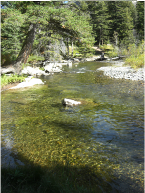
If during the June 2022 flood you observed all the debris and sediment in the streams and wondered about the impact on river water quality, you’d be in good company with the SVWC volunteers who’ve been monitoring the watershed for the past two years. Like everyone else, we were focused on the immediate threats to life and property, but we also collected some water quality data during the event, shared in this article.
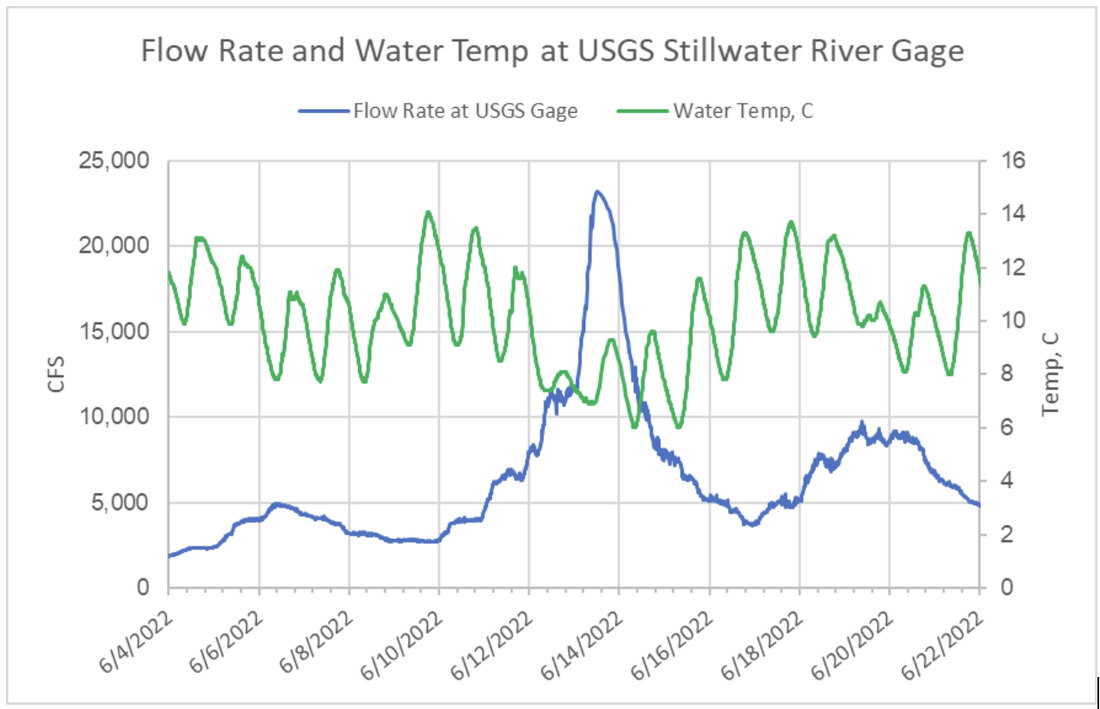
The US Geological Survey stream gaging station on the Miller Road bridge 1 mile downstream of Absarokee operated during and survived the flood, collecting valuable river stage and water temperature data. Here is a chart of the data from June 14 through June 22.
The water temperature, recorded every 15 minutes (green line in Celsius units), shows typical diurnal cycles leading up to the flood ranging from 8 to 14°C. But on June 12 it dipped sharply lower, remaining at or below 8°C as the flood peak ramped up. The very rapid mountain snowmelt caused by the large rain event produced the surge of very cold runoff, somewhat presaging the peak in streamflow. After the peak flow of June 13, water temperatures recovered to pre-flood levels over several days as the snowmelt was depleted and exited the basin. Air temperatures on June 12 and 13 were 3-5 degrees below normal but probably not a significant factor.
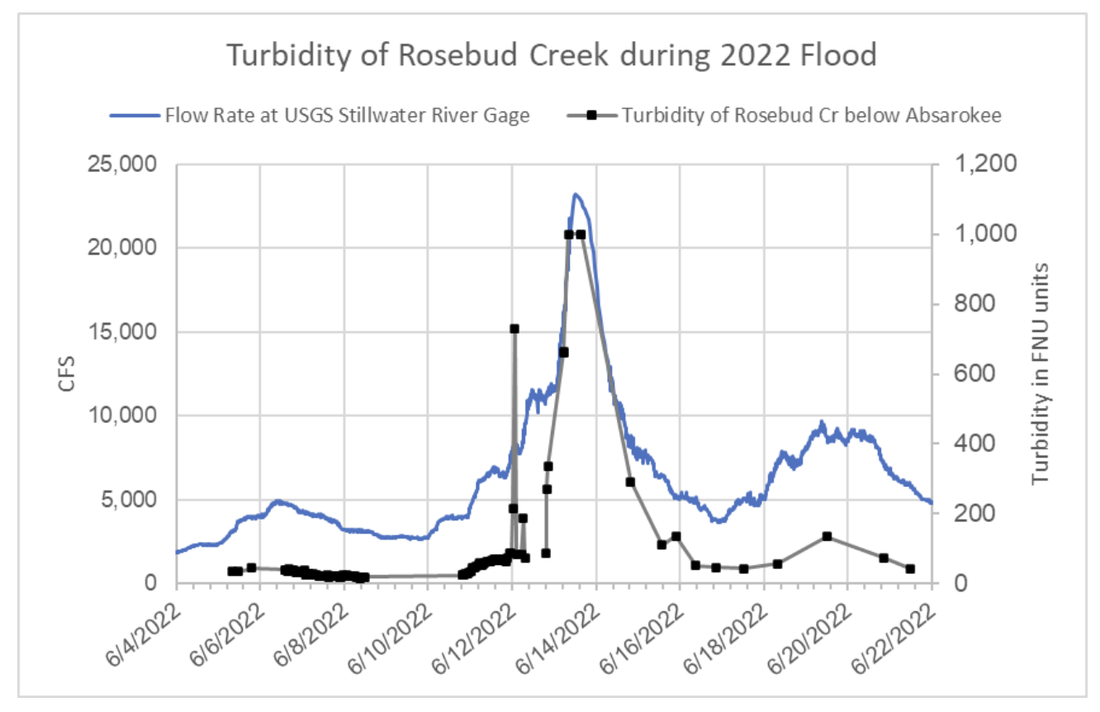
In addition to its monthly sampling program the SRWQI team deploys its Hanna field meter to monitor hydrologic events that occur outside the routine timeframe. The probe can be programmed to collect data autonomously at daily or hourly intervals. We collected data on Rosebud Creek just upstream from its confluence with the Stillwater River from early June throughout and after the June 2022 flood. This chart below shows water turbidity data overlain on the USGS streamflow hydrograph.
Turbidity is a measure of water clarity (in units called FNU) and correlates well with total suspended solids measured in a laboratory. The data show that on June 6, even though the river was quite high, 5,000 CFS, turbidity was in the range of 40 to 50 FNU units. In this range the water appears “off color” or “slightly turbid”, which we could consider typical for early season runoff in our streams. As streamflow ramped up on June 12, turbidity rose first gradually, then spiked to over 700 FNU briefly before dropping to the 80 FNU level. In this range the water would appear quite dirty having only about one foot of clarity. Early on June 13 turbidity spiked again up to and beyond 1,000 FNU. We don’t know how high exactly because values exceeded the meter’s maximum of 1,000 FNU. By the evening of June 14 turbidity dropped to 293 FNU, then declined further in the following days. However, Rosebud Creek remained turbid, in the range of 40 – 100 FNU, throughout much of June.
It's typical from the hydrologic viewpoint that during normal spring runoff turbidity and sediment load peaks hours or even days before the peak in streamflow. This is due to the fact that the sources of sediment have accumulated over the previous year and get mobilized by the rising portion of the runoff event. The June 2022 flood however, was so large that massive loads of new sources of sediment were eroded and mobilized throughout the rise to the peak, and then only slowly diminished. It’s likely that a lot of eroded sediment was dropped on the falling side of the hydrograph and may be available to be mobilized by future floods.
The US Geological Survey stream gaging station on the Miller Road bridge 1 mile downstream of Absarokee operated during and survived the flood, collecting valuable river stage and water temperature data. Here is a chart of the data from June 14 through June 22.
The water temperature, recorded every 15 minutes (green line in Celsius units), shows typical diurnal cycles leading up to the flood ranging from 8 to 14°C. But on June 12 it dipped sharply lower, remaining at or below 8°C as the flood peak ramped up. The very rapid mountain snowmelt caused by the large rain event produced the surge of very cold runoff, somewhat presaging the peak in streamflow. After the peak flow of June 13, water temperatures recovered to pre-flood levels over several days as the snowmelt was depleted and exited the basin. Air temperatures on June 12 and 13 were 3-5 degrees below normal but probably not a significant factor.
In addition to its monthly sampling program the SRWQI team deploys its Hanna field meter to monitor hydrologic events that occur outside the routine timeframe. The probe can be programmed to collect data autonomously at daily or hourly intervals. We collected data on Rosebud Creek just upstream from its confluence with the Stillwater River from early June throughout and after the June 2022 flood. This chart below shows water turbidity data overlain on the USGS streamflow hydrograph.
Turbidity is a measure of water clarity (in units called FNU) and correlates well with total suspended solids measured in a laboratory. The data show that on June 6, even though the river was quite high, 5,000 CFS, turbidity was in the range of 40 to 50 FNU units. In this range the water appears “off color” or “slightly turbid”, which we could consider typical for early season runoff in our streams. As streamflow ramped up on June 12, turbidity rose first gradually, then spiked to over 700 FNU briefly before dropping to the 80 FNU level. In this range the water would appear quite dirty having only about one foot of clarity. Early on June 13 turbidity spiked again up to and beyond 1,000 FNU. We don’t know how high exactly because values exceeded the meter’s maximum of 1,000 FNU. By the evening of June 14 turbidity dropped to 293 FNU, then declined further in the following days. However, Rosebud Creek remained turbid, in the range of 40 – 100 FNU, throughout much of June.
It's typical from the hydrologic viewpoint that during normal spring runoff turbidity and sediment load peaks hours or even days before the peak in streamflow. This is due to the fact that the sources of sediment have accumulated over the previous year and get mobilized by the rising portion of the runoff event. The June 2022 flood however, was so large that massive loads of new sources of sediment were eroded and mobilized throughout the rise to the peak, and then only slowly diminished. It’s likely that a lot of eroded sediment was dropped on the falling side of the hydrograph and may be available to be mobilized by future floods.
LEARN MORE ABOUT THE RIVER ASSESSMENT TRIAGE TEAM--CLICK BUTTON BELOW...
Click photo below to view StoryMap of the Stillwater-Rosebud Water Quality Initiative
Created by Katherine Tucker of the Ucross High Plains Stewardship Initiative at Yale School of the Environment in collaboration with the SVWC, 2021
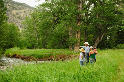
Watershed Monitoring and GIS Project Kicks Off
October 2020 - Stillwater Valley Watershed Council released its latest project aimed at monitoring the health of streams and developing geographic information system (GIS) mapping capability in the watershed. An impressive array of partners have come together for this project including the Stillwater Conservation District (DNRC), Natural Resource Conservation Service Columbus office, the DNRC’s Conservation District’s Grant Program, the FWP, the Ucross Foundation-Yale School of the Environment, and Tom Osborne, a local retired hydrologist. The project is called the Stillwater-Rosebud Water Quality Initiative.
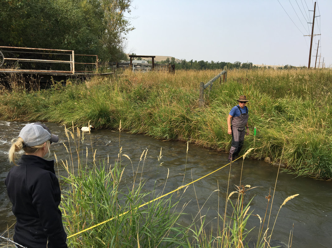
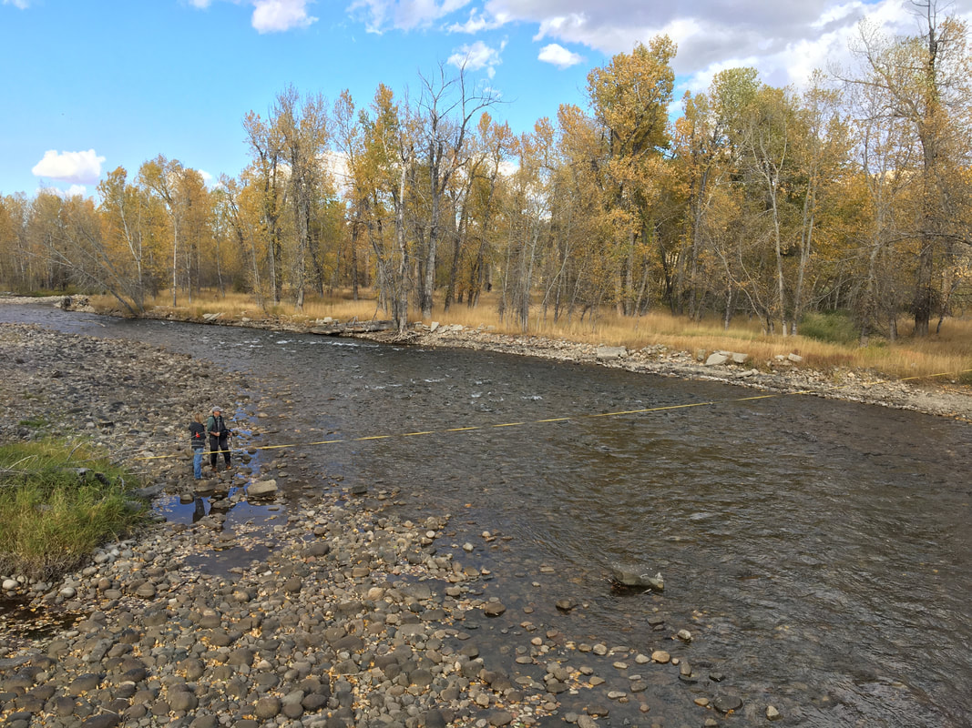
The project involves monitoring basic water quality parameters like dissolved oxygen, nutrients and sediment levels at about nine sites in the Stillwater-Rosebud drainages roughly monthly over a two-year period beginning October 1, 2020. Other than at certain facilities like the Stillwater Sibanye Mine and community wastewater plants, there have not been routine water quality monitoring in the watershed since the United States Geological Service dropped their monitoring program eight years ago. “Our streams are such a valuable asset to our lives we can’t afford to neglect their health either”, said to Tom Osborne who has volunteered to take the lead on this project with support from the SVWC board and local volunteers.
The companion GIS effort involves mapping key natural resource features in the watershed from the large bank of data sources available from state, federal and local agencies. The SVWC has at its disposal a graduate research assistant located at Yale University who, working remotely under local supervision, will pull various data layers together into a system usable by the SVWC and other local entities.
The project’s moving parts came together this summer after the SVWC was approached by Tom Osborne of Absarokee, who volunteered to help lead the work on the ground. Tom is a retired professional hydrologist who has worked on water resource projects around Montana for the past 45 years. He says that the project is looking for local students and adults interested in getting involved. For more information, contact Lindsey Clark at [email protected]; or Tom Osborne at 406.698.4120.
|
|
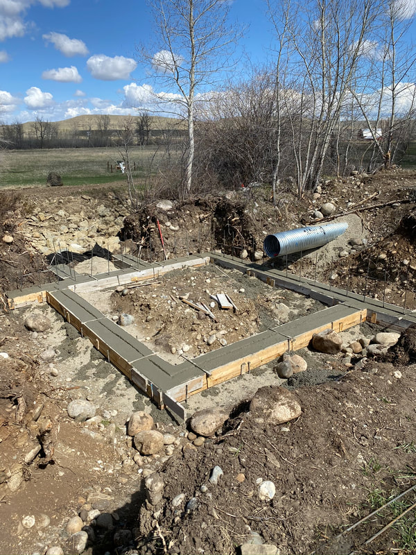
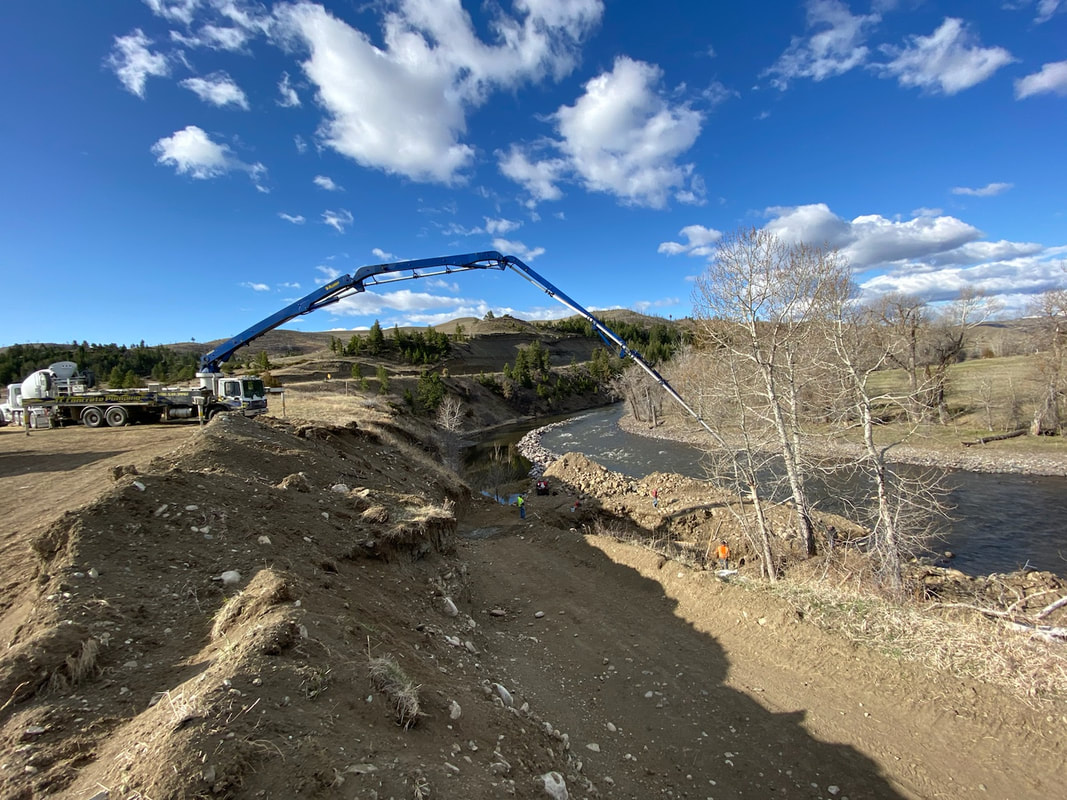
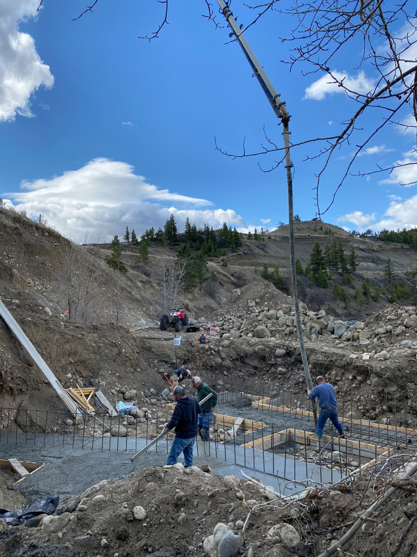
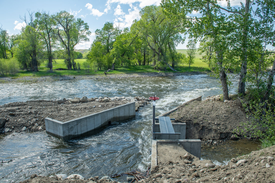
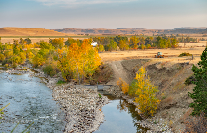
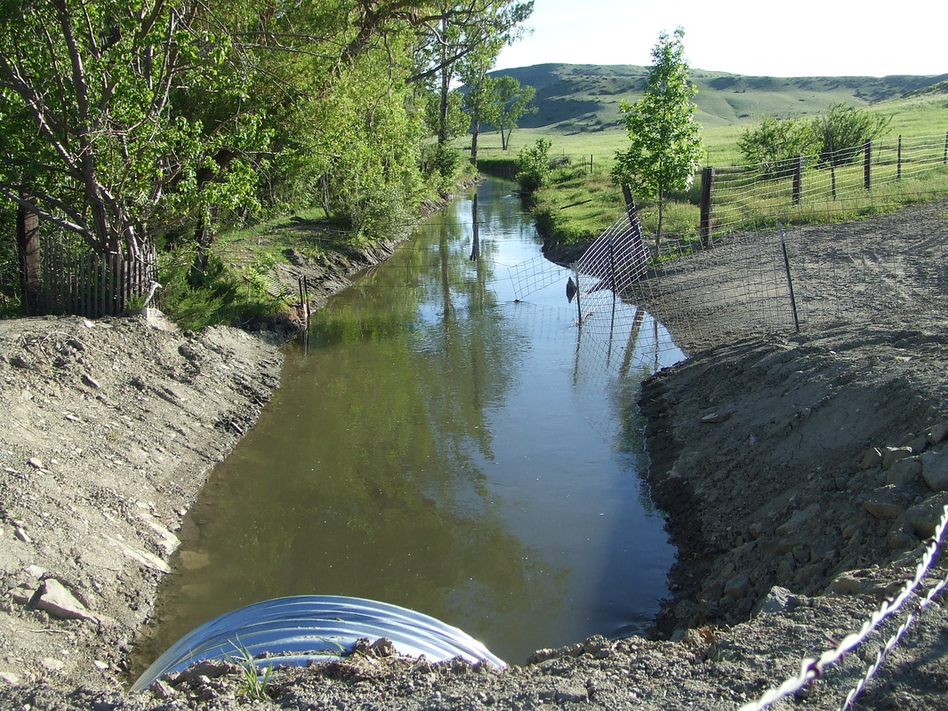
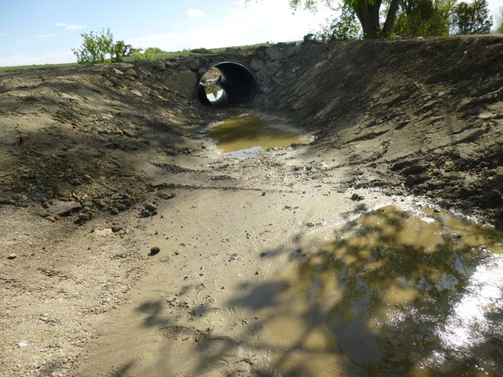
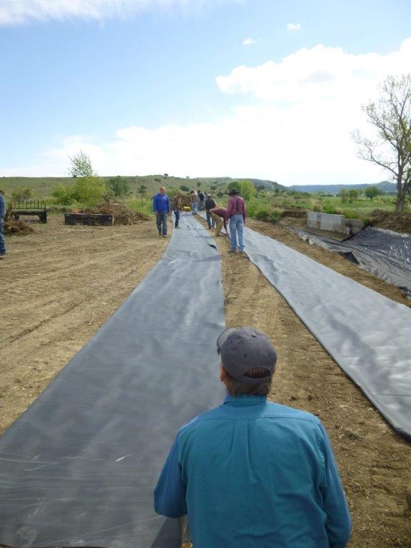
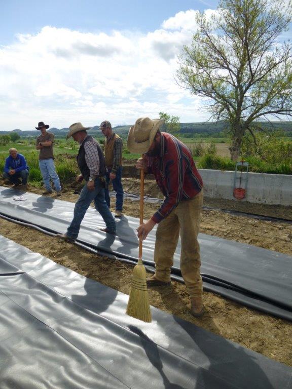
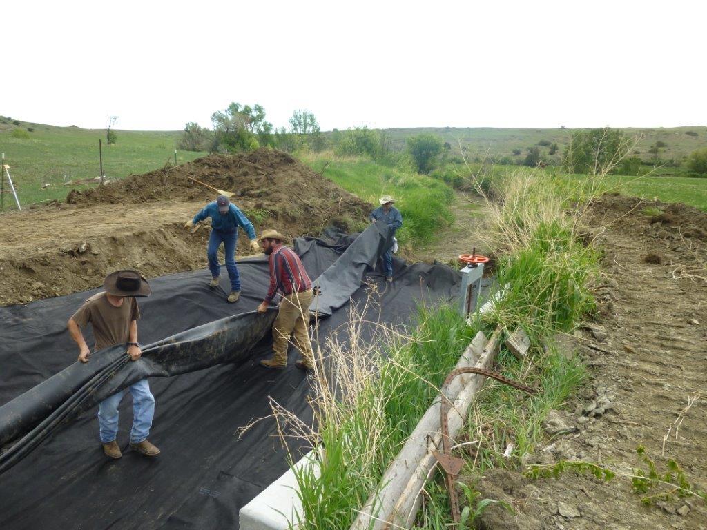
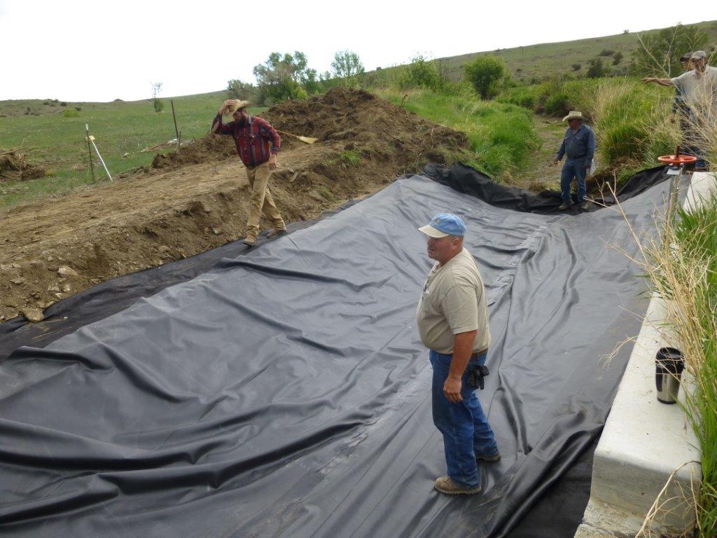
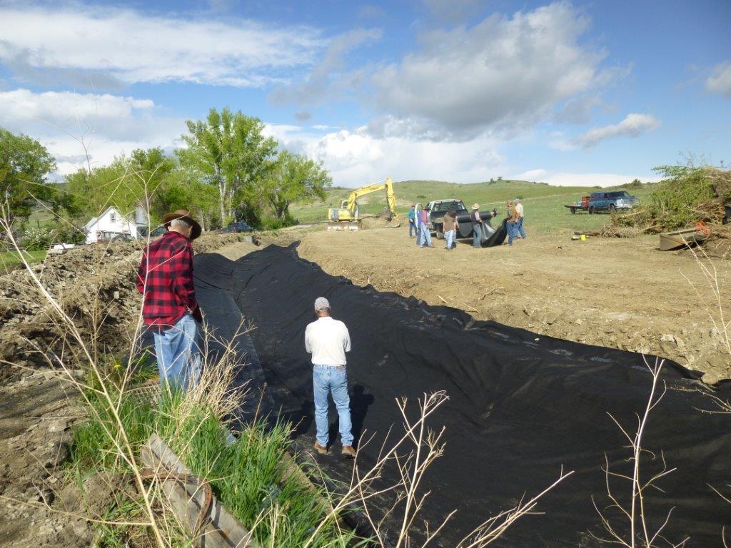
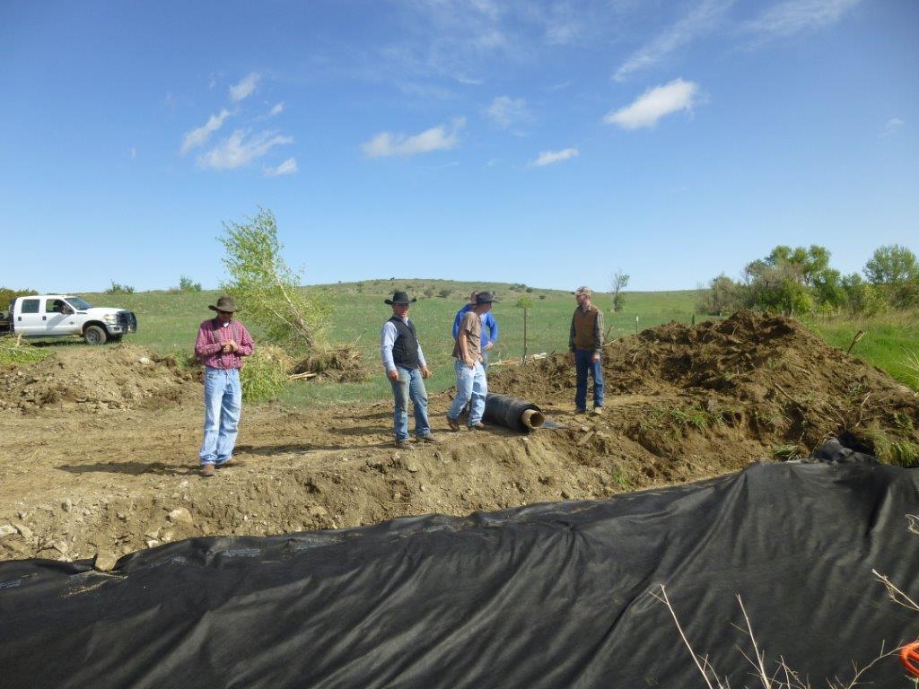
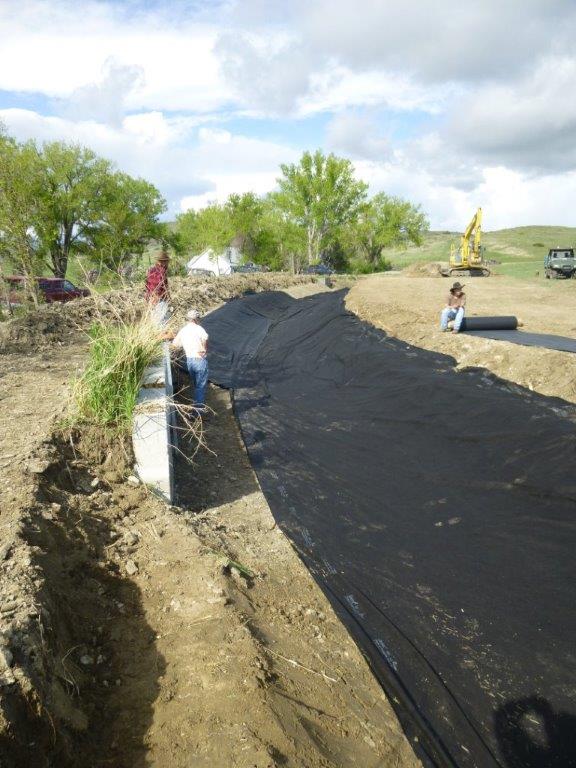
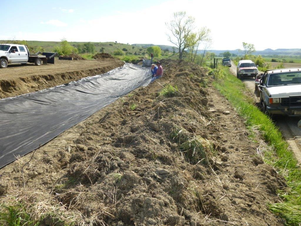
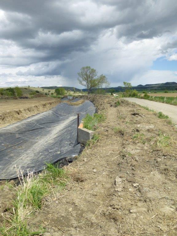
Yanzick/Brey-Riddle head gate project complete
JUNE 2020 - The Yanzick and Brey-Riddle irrigation efficiency improvement project finally complete, hiccups and all…
Any great project is not truly complete without it’s initial trials and tribulations. This irrigation project is no different. The ditch and headgate project, funded by two $125,000 Department of Natural Resource & Conservation (DNRC) Renewable Resource Grant/Loan Program Grants as well as monetary contributions from the Yanzick and Brey-Riddle ditch users, was completed May 27, 2020.
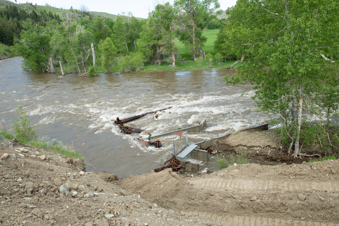
After the long awaited project was complete and only days, literally, after the celebratory site visit by engineers, contractors, agency folks, landowners and interested citizens, the early spring thaw in the Beartooths caused snow melt and subsequently record spring flows in the Stillwater River.
Although the soils were in place, after the late May stakeholder walk-through the Stillwater River discharge rate began to increase exponentially. The USGS Gage Station, located approximately 14 miles downstream of the project, recorded the peak discharge rate on May 31 at 5,500 cubic feet per second higher than the peak discharge measured on May 27.
The historic flood event, combined with the compaction of soils around the new headgate and secondary diversion structures only five days prior to the flood event, provided weak points around the structures that were susceptible to erosion. The high water level and stream energies from the Stillwater River saturated and scoured the recently compacted soils along the east headgate wingwall, ultimately flanking the headgate and allowing large volumes of water and debris to enter the Yanzick/Brey-Riddle ditch.
Upon discovery of the issue, Pioneer Technical, the engineering firm tasked with the monumental project, and local contractor, Oltrogge Construction, Inc., were notified of the damage and Oltrogge immediately mobilized to the site to complete emergency repairs.
Any great project is not truly complete without it’s initial trials and tribulations. This irrigation project is no different. The ditch and headgate project, funded by two $125,000 Department of Natural Resource & Conservation (DNRC) Renewable Resource Grant/Loan Program Grants as well as monetary contributions from the Yanzick and Brey-Riddle ditch users, was completed May 27, 2020.
After the long awaited project was complete and only days, literally, after the celebratory site visit by engineers, contractors, agency folks, landowners and interested citizens, the early spring thaw in the Beartooths caused snow melt and subsequently record spring flows in the Stillwater River.
Although the soils were in place, after the late May stakeholder walk-through the Stillwater River discharge rate began to increase exponentially. The USGS Gage Station, located approximately 14 miles downstream of the project, recorded the peak discharge rate on May 31 at 5,500 cubic feet per second higher than the peak discharge measured on May 27.
The historic flood event, combined with the compaction of soils around the new headgate and secondary diversion structures only five days prior to the flood event, provided weak points around the structures that were susceptible to erosion. The high water level and stream energies from the Stillwater River saturated and scoured the recently compacted soils along the east headgate wingwall, ultimately flanking the headgate and allowing large volumes of water and debris to enter the Yanzick/Brey-Riddle ditch.
Upon discovery of the issue, Pioneer Technical, the engineering firm tasked with the monumental project, and local contractor, Oltrogge Construction, Inc., were notified of the damage and Oltrogge immediately mobilized to the site to complete emergency repairs.
|
|
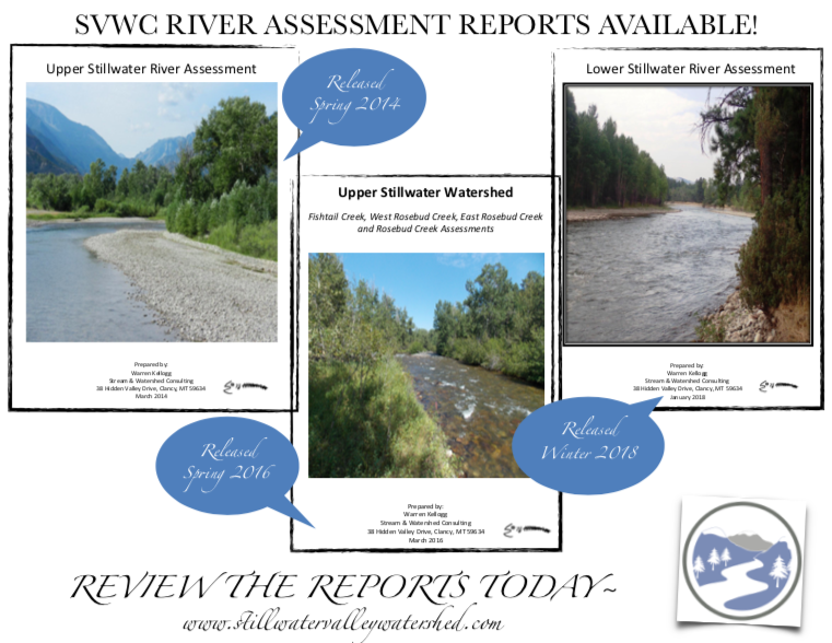
ASSESSMENT OF LOWER STILLWATER RIVER COMPLETE!
SPRING 2018 - Landowners along the Lower Stillwater River drainage heard generally good news from watershed consultant Warren Kellogg in mid-April.Kellogg presented findings from his 2017 assessment of the Lower Stillwater River, which began at the Albert Johnson Bridge and ended nearly 14 miles downstream at the Stillwater River/Yellowstone River confluence, during an April community meeting held at Fireman’s Point in Columbus.
Hired by the SVWC to follow up on his 2013 and 2015 assessments of the Upper Stillwater Valley and East & West Rosebud tributaries, respectively, Kellogg personally walked miles of stream banks. He marked sites by GPS and took notes and photographs of irrigation infrastructure, riparian corridor conditions and noxious weed infestations. Kellogg’s report contains numerous recommendations and conceptual alternatives, which are prioritized for follow-up improvement projects.
Land use along the creeks is primarily hay production and livestock grazing, with increasing small tracts and residential subdivisions farther downstream. Kellogg noted that “Some tract owners have cleared the riparian forest and built homes near the stream's edge,” he said. “These developments often include bank stabilization (rock rip-rap, jetties, dikes, etc.), in-stream pumps for landscape watering, septic systems, riparian clearing and noxious weed infestations.
In general, Kellogg was impressed by the good condition of riparian areas. While he supports the idea of riparian pastureland, with short grazing duration and livestock fenced away from stream banks, he also sees benefits in sometimes just leaving nature alone.
“Many landowners instinctually want to pull logs out of streams, and sometimes that can cost a lot,” Kellogg said. “But logs and woody debris can provide channel stability and promote fish habitat. Unless they actually pose a threat to ice dams or flooding, I'd leave them in the stream.”
That also applies to rip-rap, which is mostly found near bridge abutments and can run the gamut from rock, concrete and logs to old car bodies.
“Eroding channel banks are a natural function of streams and don't always need to be 'repaired,'” Kellogg said. “In fact, bank armor that locks the channel in place will often restrict riparian forest regeneration, trigger channel downcutting, degrade fish habitat and intensify downstream flood damage.”
In most cases, healthy riparian areas with deep roots work better than rip-rap in protecting stream banks but landowners need to promote age diversity to ensure saplings are growing to replace mature trees over time – in other words, not mowing down riparian areas to promote views.
Kellogg reported finding a variety of noxious weeds along the corridor. “Noxious weeds found along the lower Stillwater River corridor pose a significant economic and ecological impact to the riparian and wetland plant communities.”
Kellogg also looked at numerous headgate structures and discovered several systems that are over 120 years old. The infrastructure (i.e. headgates, diversions, siphons, conveyance ditches, ditch turnouts, etc.) associated with these systems vary in age and condition. A comprehensive evaluation of the larger irrigation systems is recommended.
Kellogg's report can be found on the Stillwater Valley Watershed Council's website. Hardcopies of the 80 page compilation, complete with aerial photo maps, can be purchased for $45 from the SVWC or are available from the Columbus public library.
“Water is the driving force of all nature.” - Leonardo De Vinci
Consultant Issues Final Report on Rosebuds River Assessment
By Richard Hanners
Stillwater County News Reporter
Originally released by SCN on June 2, 2016
MAY 2016 -Landowners in the Rosebud drainages heard generally good news from watershed consultant Warren Kellogg last week – stable channels, “darn good” riparian areas and a well supported war on weeds.
Kellogg presented findings from his 2015 assessment of the East Rosebud, West Rosebud and Fishtail creeks during the annual SVWC Spring Forum held on May 25. Hired by the SVWC to follow up on his 2013 assessment of the Upper Stillwater Valley, a majority of funding came from a $15,000 DNRC grant while a portion was also matched by the SVWC.
In both studies, Kellogg personally walked miles of stream banks, marking sites by GPS and taking notes and photographs of irrigation infrastructure, riparian corridor conditions and noxious weed infestations. His report contains numerous recommendations and conceptual alternatives, which are prioritized for follow-up improvement projects.
Kellogg's report covers 0.4 miles of West Fishtail Creek, 13.7 miles of Fishtail Creek divided into four reaches with 54 sites, 21 miles of West Rosebud Creek divided into four reaches with 52 sites, 12 miles of East Rosebud Creek divided into four reaches with 50 sites, and four miles of Rosebud Creek with 19 sites.
Land use along the creeks is primarily hay production and livestock grazing, with some small tracts and residential subdivisions that pose threats to area streams, Kellogg said.
“Some tract owners have cleared the riparian forest and built homes near the stream's edge,” he said. “These developments often include bank stabilization (rock rip-rap, jetties, dikes, etc.), in-stream pumps for landscape watering, septic systems, riparian clearing and noxious weed infestations.
Individual small tract impacts to streams may be minimal, but cumulatively they pose a growing threat to the long-term health of the Rosebud Creek drainage.”
In general, Kellogg was impressed by the good condition of riparian areas. While he supports the idea of riparian pastureland, with short grazing duration and livestock fenced away from stream banks, he also sees benefits in sometimes just leaving nature alone.
“Many landowners instinctually want to pull logs out of streams, and sometimes that can cost a lot,” Kellogg said. “But logs and woody debris can provide channel stability and promote fish habitat. Unless they actually pose a threat to ice dams or flooding, I'd leave them in the stream.”
That also applies to rip-rap, which is mostly found near bridge abutments and can run the gamut from rock, concrete and logs to old car bodies.
“Eroding channel banks are a natural function of streams and don't always need to be 'repaired,'” Kellogg said. “In fact, bank armor that locks the channel in place will often restrict riparian forest regeneration, trigger channel downcutting, degrade fish habitat and intensify downstream flood damage.”
In most cases, healthy riparian areas with deep roots work better than rip-rap in protecting stream banks, Kellogg said, but landowners need to promote age diversity to ensure saplings are growing to replace mature trees over time – in other words, not mowing down riparian areas to promote views. “Eighty-five percent of the riparian corridor on the East Rosebud is in good shape and should look the same in a hundred years,” he said.
Kellogg reported finding a variety of noxious weeds along the corridor. He also looked at dozens of headgate structures – averaging one per mile – and had recommendations for reducing maintenance costs on many structures.
Kellogg's report can be found on the Stillwater Valley Watershed Council's website. Hardcopies of the 100 page report with 22 aerial photo maps can be purchased for $60 or will be available at public libraries around the county.
Projects Underway from Stillwater River Assessment
DECEMBER 2015 - Water quality ranks high on the priority list of the Stillwater Valley Watershed Council’s mission. Because of this mission and interest from area landowners to prioritize mitigation projects that will improve natural resource issues along our tributaries the SVWC, teaming with the Stillwater Conservation District, commissioned a comprehensive assessment of three stream reaches in the upper Stillwater Valley in 2013. This project was made possible by a Department of Natural Resources Conservation 223 grant.
The primary objectives for the assessment were to target the Stillwater River (30.3 miles), the West Fork of the Stillwater River (6.2 miles), Lodgepole Creek (4.7 miles), Limestone Creek (2.1 miles), and Little Rocky Creek (2.3 miles) in order to: a) collect and summarize resource information with special attention given to irrigation infrastructure, riparian area restoration, and noxious weed infestations, and b) provide recommendations and prioritization on restoration opportunities.
Warren Kellogg, a professional in stream corridor assessments, was hired to undertake the project which was completed in the fall of 2013 with the subsequent report released in spring 2014. According to Kellogg, human impact has occurred in the upper Stillwater Valley over the last 120 years, but compared to many streams in Montana, their impact is minimal. For the most part, the upper Stillwater streams are in good condition.
From the report, the SVWC and SCD boards as well as interested landowners ranked projects prioritized by Kellogg. Shortly thereafter, the Yanzick and Brey/Riddle ditch users approached the SVWC and SCD boards about sponsoring a project on their irrigation diversion structures. The ditch users’ desire to improve water use efficiencies and eliminate annual disturbances to the Stillwater River prompted them to look into options to resolve this issue. Because these projects ranked high on the SVWC and SCD’s priority list and the close proximity of the two headgates and the interaction between the diversions, it was a clear decision by both boards to address this as one project.
The first step in determining potential solutions to the identified issues on the Yanzick & Brey/Riddle irrigation structures is to commission a professional engineering firm to complete a preliminary engineering report (PER). A PER will allow all stakeholders involved to consider recommendations generated from an engineer and proceed with a preferred alternative that will improve river stability, aquatic habitat, and public safety.
The SVWC and SCD applied for and recently received $10,000 from a DNRC Renewable Resource Planning Grant to fund this PER. Other match funds for the project came from water users on the Yanzick headgate and Brey/Riddle ditch, with project oversight being provided by the SVWC and SCD. The PER is expected to be complete by spring 2016 in which a public meeting will then be held to determine the best alternative.
Meanwhile, Kellogg recently completed the ground work for a comprehensive river assessment on the East and West Rosebud Creeks and Fishtail Creek. The majority of funding for this project came from a DNRC 223 grant in the amount of $15,000. The remaining required funds will come from the SVWC’s general operating budget with project oversight from the SCD and SVWC. A preliminary report from this assessment will be presented by Warren Kellogg at the SVWC’s annual meeting scheduled for January 30, 2016 in Fishtail.
Second River Assessment Complete
East & West Rosebud Creeks and Fishtail Creek Assessment Complete!
OCTOBER 2015 - The SVWC, working in partnership with the Stillwater Conservation District, secured funding from a Resource Planning Grant from the Department
of Natural Resource and Conservation to pursue a professional comprehensive stream corridor assessment of approximately 55 miles of East Rosebud Creek, West Rosebud Creek and Fishtail Creek. The goal of the hydrologic/geomorphic assessment is to:
- Provide a baseline for future stream migration and produce options for mitigation projects with the overall goal of protecting private property and agricultural lands as well as improving fish habitat in order to ensure resource sustainability.
- Provide solutions for irrigators by eliminating the need for costly diversion repairs and/or relocations that would possibly disrupt healthy fisheries, produce unnecessary in-stream excavation activities, and create unstable erodible stream bank areas.
- Provide conceptual alternatives for long-term improvement of the tributaries for the 100+ landowners adjacent to the targeted tributaries.
Upper Stillwater River and Select Tributary Hydrologic Assessment Complete
OCTOBER 2013 - In 2013, the SVWC received a 223 Grant from the Department of Natural Resource Conservation Service (DNRC) in the amount of $15,000 to fund a comprehensive assessment of three stream reaches located in the upper Stillwater Valley. This project was commissioned in order to prioritize mitigation projects that will improve natural resource issues such as streambank erosion, as well as irrigation related improvements.
Warren Kellogg, based out of Clancy, Montana, was hired by the SVWC to perform the assessment. Warren has worked closely with Montana watershed groups since 1977. He was raised on a Montana ranch and has a life-long background in agriculture, landowner relations, environmental sciences, geographic technology, watershed management, resource assessments, project planning and development, and group facilitation. Over the last 35 years, Warren has worked with landowners, watershed groups and conservation districts throughout Montana in all aspects of watershed planning and stream corridor assessments.
The stream assessment included the Stillwater River (30.3 miles), the West Fork of the Stillwater River (6.2 miles), Lodgepole Creek (4.7 miles), Limestone Creek (2.1 miles), and Little Rocky Creek (2.3 miles). Each waterway was walked in late July and August of 2013. As part of the assessment, Warren also spoke with several landowners and water users along these streams.
The primary objectives for the assessment were to: a) collect and summarize resource information with special attention given to irrigation infrastructure, riparian area restoration, and noxious weed infestations, and b) provide recommendations and prioritization on restoration opportunities. According to Kellogg, human impact has occurred in the upper Stillwater Valley over the last 120 years, but compared to many streams in Montana, their impact is minimal. For the most part, the upper Stillwater streams are in good condition.
A potential long-term impact is the extensive development of small tracts. During the 1960s, small tracts began to sell and were developed in earnest. Many of these tracts have various types of bank stabilization to protect houses and outbuildings, septic systems that may need maintenance or replacement, domestic water withdrawals from the streams, and noxious weed infestations. Individual tracts by themselves have a minimal impact on the stream, but cumulatively can provide long-term threats to stream health.
Restoration opportunities are commonly associated with irrigation diversions and turnouts. Irrigation infrastructure is often 50 to 100 years old and in need of replacement. Recommendations and options will be suggested on making some of these in-channel structures more functional, cheaper to maintain, and compatible to the changing conditions of the stream.
Warren Kellogg gave a presentation of his results and recommendations at the Stillwater Valley Watershed Council’s Annual Meeting on February 1, 2014. However, the comprehensive stream corridor assessment report, with project maps, was produced and presented to the Stillwater Valley Watershed Council in March. This assessment report, including recommended restoration priorities, conceptual alternatives, and GIS reference maps based upon field observations and landowner interviews are available on the River Assessment Report page.
Garrigus Ditch Efficiency Improvement Project Deemed a Success!
JUNE 2013 - The Garrigus Ditch Efficiency Improvement Project was a success due in large part to a $2772 grant the SVWC and Garrigus Ditch users received through the Stillwater Conservation District and DNRC. Additionally, the SVWC board voted to donate another $4000 to help offset additional project costs not covered under the grant.
The efficiency of irrigation water flow was significantly increased along 3700’ of the Garrigus Ditch which is located south of Absarokee. Previous water losses measured in September 2012 were between two and 10 cubic feet per second (cfs), causing former pasture and cropland to be inundated with substantial amounts of water, resulting in severe ponding and flooding. According to the Stillwater NRCS, in one particular location where a culvert was replaced and the ditch was lined as part of the efficiency improvement project, water flow measurements taken in June 2013 measured nearly 27 cfs, compared to only 18 cfs the previous fall.
By reducing the excessive ponding and flooding caused by structural issues on the Garrigus Ditch, the 360 acres of inundated land was reclaimed and produced quality hay and pasture during the summer of 2013 (the first time in years). Additionally, another 400 acres was able to be properly irrigated, maximizing its productive capability as well.
After only one season, according to several of the ditch users, the impacts of the project were evident. Hay was harvested throughout the summer in areas that have not seen a swather in nearly 35 years. Pastures and hayfields, previously so inundated with water that irrigation was not necessary, were being irrigated efficiently and producing quality grasses in 2013. Although not a conservation benefit, one water user was quoted as saying, “The thing I really appreciate is that everybody came together as ditch owners and pitched in to help get the ditch fixed properly.” This may provide more long-term benefits for the Garrigus Ditch’s preservation than any excavator ever could.

Potential Devastating Effects of the West Fork of the Stillwater River
JULY 2012 - Landowners along the lower West Fork River should be advised of a couple situations with the potential for major negative effects on the West Fork’s channel system. Residents in the Berkley Subdivision should be made aware of an active landslide on the south bank of the West Fork River. There is a high potential of landslide activity during high water which could then divert the West Fork north into the subdivision.
Landowners along the lower section of the West Fork should be advised that the West Fork is eroding the south river bank at the mouth of Horseman Creek. The area of concern is 1.5 miles up Limestone Road. This has the potential of transferring the river’s system into an old river channel that exits at the Nye Trading Post. Through the Stillwater Valley Watershed Council, structure exists to collaborate with the neighborhood to find an equitable solution for the aforementioned potentially devastating occurrences.
Landowners along the lower section of the West Fork should be advised that the West Fork is eroding the south river bank at the mouth of Horseman Creek. The area of concern is 1.5 miles up Limestone Road. This has the potential of transferring the river’s system into an old river channel that exits at the Nye Trading Post. Through the Stillwater Valley Watershed Council, structure exists to collaborate with the neighborhood to find an equitable solution for the aforementioned potentially devastating occurrences.
Changing Corrals, Corralling Change, Managing the Difference
AUGUST 2011 - Since the start of the Stillwater Valley Watershed Council, we have been working in cooperation with the Beartooth Stock Association (BSA) on their program to reduce water contamination from livestock confinement areas: "Changing Corrals, Corralling Change, Managing the Difference." This program strives to raise the awareness of livestock producers on the issues created by runoff from livestock confinement areas entering surface waters and to help producers who want to improve water quality on their operation find funding sources to aid in making these improvements.
Thanks to the efforts of local working groups, assistance has been granted from the Grazing Lands Conservation Initiative (GLCI), Montana Farm Bureau Federation, Future Fish (through Montana Fish, Wildlife, and Parks), NRCS, and both cash and in-kind support from numerous private individuals. These programs have helped supplement funds and labor from the individual producers. The "Changing Corrals" program has increased awareness of several local producers who have modified their livestock confinement areas to greatly reduce livestock waste from entering our water sources.
One major source of funding for the "Changing Corrals" project is the Environmental Quality Improvement Program (EQUIP) offered through the NRCS. Because of the efforts of the BSA and the SVWC, Stillwater County has been allocated extra funding through the EQUIP program to aid water quality improvement projects. Next year's budget for these projects in Montana is $945,000. Additionally, NRCS has an agreement starting in 2013 with the Montana Department of Environmental Quality (DEQ) that allows producers to be eligible for the EQUIP program without having to get a discharge permit from the DEQ, saving producers additional paperwork and costs.
One major source of funding for the "Changing Corrals" project is the Environmental Quality Improvement Program (EQUIP) through the NRCS. Through the efforts of the BSA and the SVWC, Stillwater County has been allocated extra funding through the EQUIP program to aid water quality improvement projects. Next year's budget for these projects in Montana is $945,000. Additionally, NRCS has an agreement starting in 2013 with the Montana Department of Environmental Quality (DEQ) that allows producers to be eligible for the EQUIP program without having to get a discharge permit from the DEQ, saving producers additional paperwork and costs.